
It’s that time of year when I start tinkering with gadgets and software…
A new piece of free software has just come out which is quite cool. It allows users to collate and search multiple sonar tracks from Humminbird side imaging fish finders. I store the side imaging tracks on my PC – but it has always been a chore to find the tracks when you want to plan a new trip (the folder naming is not intuitive so it takes ages to find the right one)…
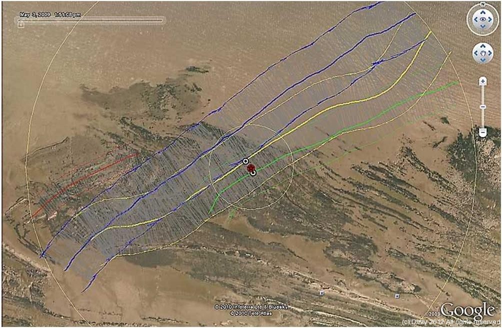
Humfinder will search through your folders and plot the side imaging tracks – allowing you to see them in Google Earth.
This shows the multiple tracks I have recorded from Blue Anchor Bay…
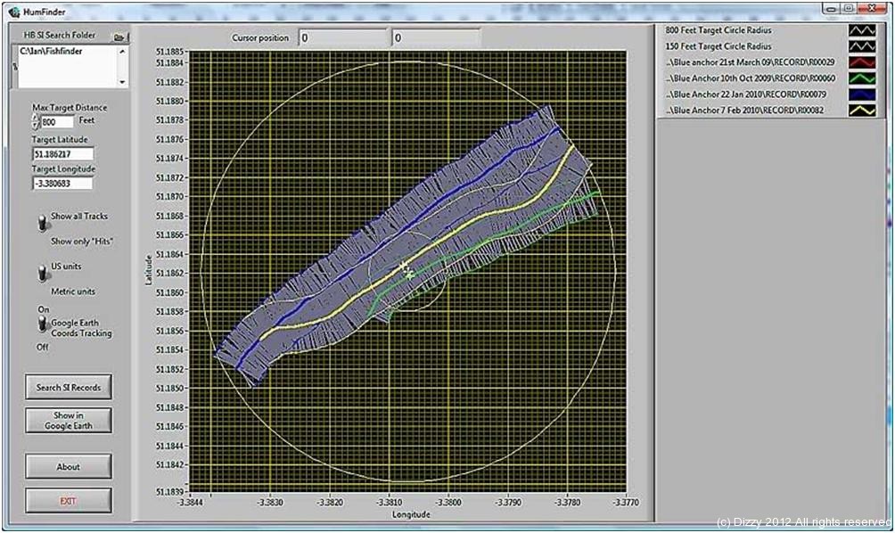
It colour codes and labels the different side imaging plots so you can see if you have missed coverage (or if you have overlapping plots, you might want to view the same obstacle from different angles eg. a wreck). This can then be viewed in Google Earth…
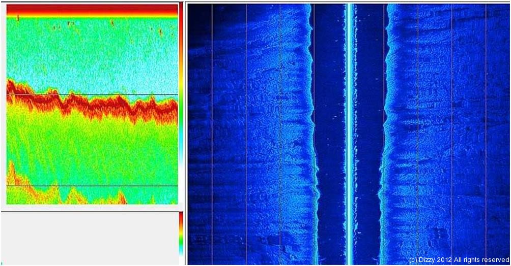
Then you can use one of the other free bits of software (I mainly use Humviewer) to view the bit you are interested in (if you click on the bit you are interested in you can use the track time to move to the same location).
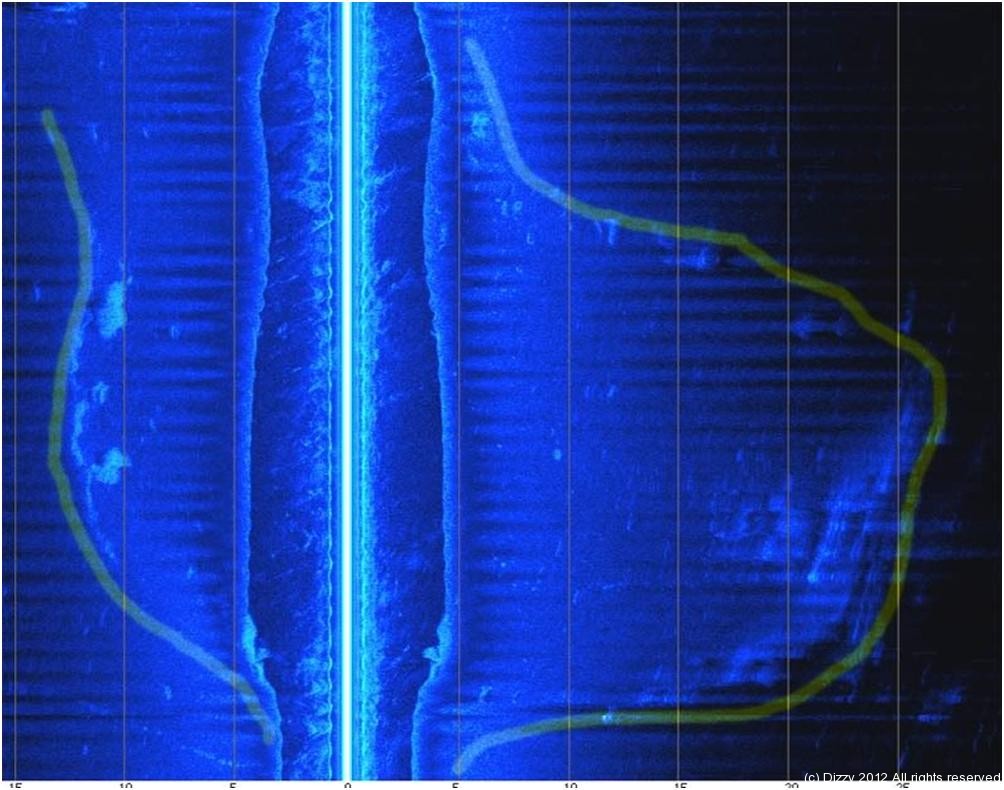
The following two snapshots from Humviewer show the same areas but from different angles…
OK, it would be much more interesting if there was something interesting on the sea bed to look at  ….
….
So how about a reserviour which used to be farm land and was then flooded ?
Well, we have several of those and one of them is quite close to me, namely Chew Valley lake.
And if you could get a map which showed features, contours, rivers and farm building BEFORE the land was flooded and then overlayed that on top of the lake as it is now using Google Earth, then you would come up with something like this….
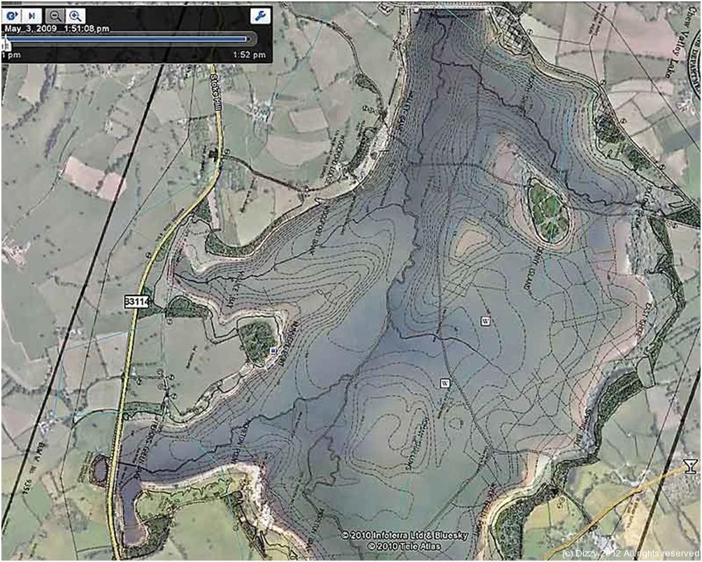
You can see the lake as it is with the surrounding countryside from Google Earth, but you can also see where the old rivers, farm buildings and hills/valleys were. The valleys are now deep bits of the lake and the hills are shallows (eg. The Roman Shallows – famous for its dry fly fishing in the summer). They knocked the buildings down when they flooded the land – but many bits still remain – more importantly, the river beds are still there.
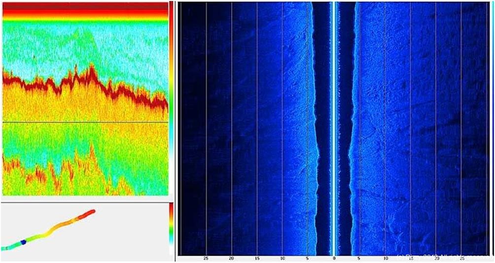
One feature which I found with the side imaging sonar last year at Chew Valley lake, was the pool below what used to be Moreton Mill. Used the coordinates to guide me in using GPS from my homework…
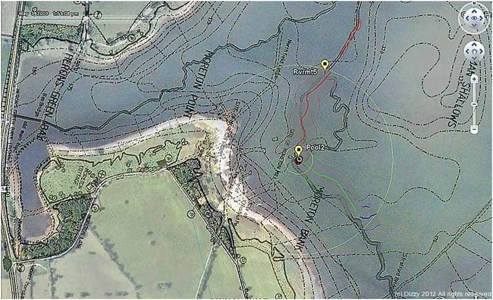
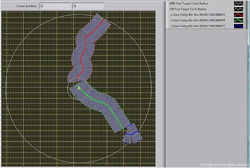
I had several plots which came close, as Humfinder shows…
Found the mill pool quite easily – there is a 6 foot drop in the depth when you reach the pool – which is very noticeable even on the traditional 2D fish finders (LHS of pic below) …
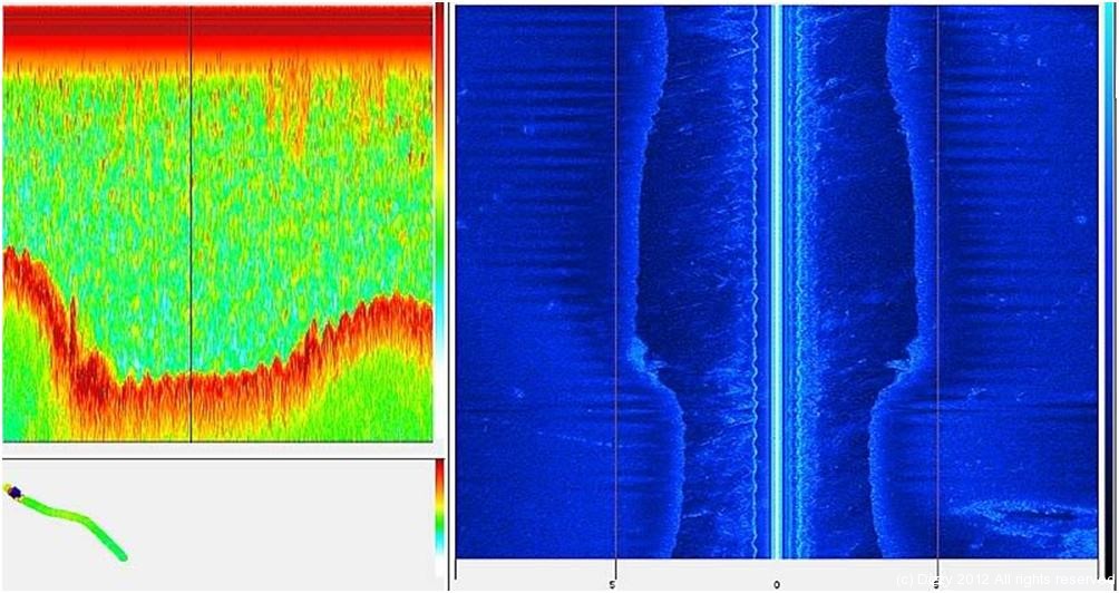
And this is what it looks like from the side imaging – even the shape is the same as it is on the original map – how cool is that…
I have also found the remains of the farmhouses, roads and even old tree stumps using the side imaging. Oh, and lots of really big pike – which also show up quite well on it – One day I will catch one of those monsters 